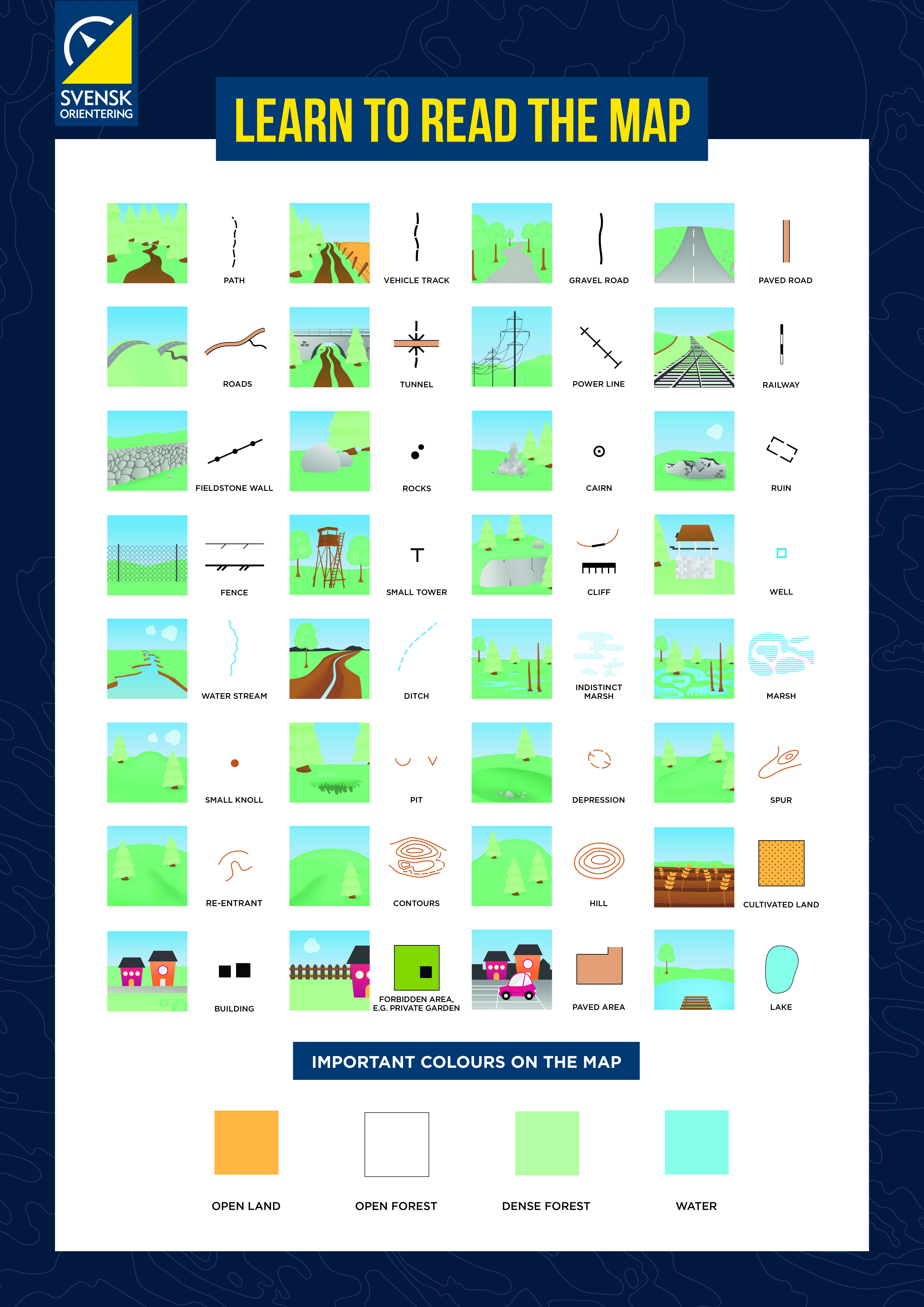
The map
Specifically designed to be used within orienteering, the map features different symbols and colors that represent various natural objects and terrain surfaces.
History
Originally, the sport of orienteering used maps featuring a scale of 1:100 000, but gradually the scale got enlarged. In 1977, the base scale was changed to 1:15 000.
Map scale
There are maps in different scales. The scale represents how much the map has been reduced.
Competitions and practice events often use a scale of 1:10 000 or 1:7 500 while sprint events use a scale of 1:5 000 or 1:4 000.
A simple rule of thumb is to delete the last two digits to find out the ratio between the terrain and the map. One centimeter on the map represents 100 meters on the ground.
Requirements
The maps also need to meet a specific set of requirements called the Specification for Orienteering Maps.
Map features